The smell of the rain

The smell of the rain

IMG_5233

When you live in a country where rain is a regular occurrence, it becomes a fact of life, almost an annoyance. Particularly in areas where precipitation is a year round affair and where the prospect of uninterrupted spells of rainfall implies inconvenience, damp and blocked sunlight for long periods of time, the subject of rain becomes a topic of distaste; a phenomenon which necessitates the need to temporarily flee one’s normal abode in search of warmth and sunshine.

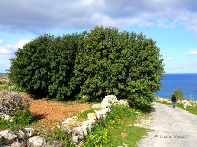
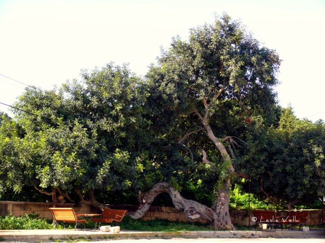
Not so in places where rain is not so common. Such as Malta during the long, hot, dry summer season. A place where week after week of warm to hot sunny days prevail almost uninterruptedly between late spring and late summer: around twelve weeks of hot, dry weather which burns the countryside dry and lets you wonder at the resilient patches of green vegetation which defy the furnace-like quality of what they face and survive almost without a drop of soothing water for sustenance, except for the occasional heavy dewfall which is absorbed through their leaves.

Those of us who inhabit such areas are generally sensitive to a particular sensation which is most magnified when it rains after a long dry period. I term this sensation, the smell of the rain. A wonderfully rich and refreshing earthy smell which brings great joy. An indicator of change to come. The first airborne drop of relief in advance of wetter days ahead.

I used to think that this sensation was something that was simply an undefinable feeling. Some primitive switch to which humans in dry places are programmed to respond. Until an architect friend of mine told me that there is actually a word for it! Petrichor. A combination of two distinct words, petra and ichor designed to embrace and encapsulate the feeling that has been arousing my senses since childhood.

Petra stands for stone while ichor stands for the more esoteric fluid that flowed in the veins of the Gods in Greek mythology! So there you have it: a heavenly fluid mixing with the very earth on which we lesser human mortals stand. Producing a sensation of what flows through the Gods’ own veins! No wonder the feeling of euphoric refreshment which the smell of the first rain brings.

Researchers theorise that the smell of the rain, or petrichor is caused by a combination of factors. Part of the smell derives from an oily substance exuded by certain plants during dry periods which is absorbed by clay and rocks on the ground. When it rains after a lengthy dry spell, the oil is released into the air along with another compound, geosmin, a metabolic by-product of certain bacteria which is emitted by wet soil, producing the distinctive scent. The smell can be further compounded by ozone which is generated by lightning during a thunderstorm.

The purpose of the oil is to slow down seed germination and plant growth during the lethal dry season. It is only when the rain dissipates the oil in the ground that the seeds get the go-ahead to germinate. This would indicate that the plants produce the oil in order to safeguard the seeds from germination under duress.

Just imagine what is taking place whenever you feel this exuberant high! As each raindrop lands on the porous surface of the sun-baked ground, air trapped in the pores forms small bubbles, which float to the surface and release spray-like aerosols.  Such aerosols carry the scent, as well as bacteria and viruses from the soil. Gentle rainfall tends to produce more aerosols which explains why petrichor is stronger and more noticeable after light rains.

As to why it excites us so much? Scientists believe that humans react so joyfully to the smell of the rain because our ancestors may have been hard-wired to rely on rainy weather for survival.

Blood of the Gods splashing on dry stones or complex organic chemicals released by plants and bacteria? Whatever the origin, the magic remains for all those who like me are sensitive to its timeless pleasure.


A clothes line amidst the fennel stalks.

DSCN4822 2 pixlr signed

A clothes line amidst the fennel stalks.

A hot August morning on Comino. The rising sun’s heat is tempered by the occasional straggling cloud providing a few overcast seconds of relief and a stiff breeze of Majjistral, Malta’s prevailing north west wind which is nature’s alternative to refreshing air conditioning.

We are on our annual pilgrimage to this desolate little island. Arid, but full of life. Ruggedly beautiful with ever changing scenery. A two and a half square kilometre island. One tiny corner of which, its Blue Lagoon, is over-run by up to five thousand visitors daily. Leaving the rest to people like us. A fair deal, I think. Amazing how even on such a small landmass, you can just climb the small hill overlooking Cominotto Island and all evidence of the crowds dissipates into thin air. No sight, no sound. Nothing.

We have climbed from the inlet of San Niklaw and walked across Comino’s main thoroughfare, Triq Kemmunett. At the location of the old Bakery building we take a sharp right and climb steeply up Triq il-Gvernatur, the road leading to the imposing Santa Maria Tower, part of a network of coastal watchtowers built by the Knights of St. John.

Our final destination today is the small mooring place at Wied Ernu, a tiny cleft in the island’s southern coast which used to serve as the landing for boats from Malta during the time of the twentieth century agricultural colony on Comino.

The colony is long gone, but its remains, mostly in ruins and disrepair are spread all over the island.

On the way back, a small sign of human activity. One of the handful of people which stayed behind when the colony disbanded in the late 1960s. True Comino-born and bred. Hanging clothes to dry on a line. Surrounded by stalks of wild fennel.

A beautiful sight. A sign of humanity’s resilience and adaptability. And oneness with nature.

The fresh breeze, the aromatic smell of ripening fennel seeds and the slight waft of damp, clean laundry hanging out to dry in the wind. Elements which make me return to Comino year after year.

Of carob pods and carats


5307625114_87e7994a57_o signed

Walking in the Mellieha countryside this weekend, in the traffic-free and solitary whereabouts of Ghajn Tuta, I came across an ancient carob tree laden with ripe pods. The carob, known to science as Ceratonia siliqua and as harrub to the Maltese is a hardy evergreen tree which graces the Maltese landscape and retains a canopy of green in the otherwise parched and dry summer Mediterranean landscape.

The carob is an evergreen flowering shrub, belonging to the pea family. It is native to the Mediterranean region especially in the eastern and southern area of this great Sea and is a very common species here in Malta where it grows without much care or cultivation and is legally protected, although countless ancient carobs unfortunately continue to be regularly uprooted to make way for development.

The carob’s fruit, its pod, has been consumed since ancient times by the peoples of the Mediterranean. The Bible makes numerous references to it such as in the parable of the Prodigal Son where the man who squandered all his riches and ended up working as a swineherd, longed to fill his stomach with the pods that the pigs were eating, but no one gave him anything”.

On the basis of another biblical reference, it is also known as Saint John’s Bread or locust bean given that when Jesus’ cousin John the Baptist was fasting in the desert, “the same John had his raiment of camel’s hair, and a leathern girdle about his loins; and his meat was locusts and wild honey.” The locusts referred to in the biblical passage are not of the grasshopper variety but carob pods!

In Malta the ripe carob fruit is used to produce a syrup called “Gulepp tal-Harrub” which is used to treat chest colds and coughs and also forms the basis of the “karamelli tal-harrub” sweets which are popular for consumption during Lent when it is forbidden to consume sugary sweets. In times of scarcity, the carob pod was ground into a flour to produce bread. During the siege of Malta in World War 2, carob pods became highly prized for their nutritional value and fetched the highest-ever recorded market price of a penny a pod!

IMG_4982 pixlr signed

I prefer to eat my carob pods straight from nature. Detached from the tree, rinsed under clean, running water and chewed one small mouthful at a time. Beware of the very hard seeds inside the pod which can easily break a tooth! Eat them in the countryside and spit the seeds onto the soil to help propagate new trees or savour them at home. An unrefined, woody sweet flavour which leaves a delectable aftertaste in one’s mouth!

But does one simply eat carobs for fun? There are many ascribed nutrition and health benefits which can be summarised as follows:

Carob tannins contain Gallic acid that works as an analgesic, anti-allergic, antibacterial, antioxidant, antiviral and antiseptic. It improves digestion and lowers cholesterol level in the blood and is used for treating bowel disorders in children and adults alike. Since it does not contain caffeine, carob is beneficial for people with high blood pressure.

The vitamin E content in carob helps in treating cough, flu and anaemia while the Gallic acid helps in preventing and treating polio in children. Carob fights against osteoporosis due to its richness in phosphorus and calcium. Carob pod husks are chewed by singers to clear the voice and throat.

And the seeds? Small and hard there is not much of a culinary use and unless you wish to plant them in a pot to grow little carob trees, just throw them away into the countryside where they may either take root or serve as food for the birds. But have one final look at them and hold one in your hands. For the humble carob seed you are holding was used by the ancients as a unit of measure for weighing gold and precious stones.  The carob’s scientific name Ceratonia siliqua originates from the Greek name for carob seeds: keration.  The word carat used in this sense is a corruption of this Greek word!

4231183118_eb5277183d_o signed

Dining with the Dear Departed

DSCN9552 pixlr signed

Dining with the Dear Departed.

In many cultures the concept of a wake takes place to bid farewell to the deceased. A wake is very often a social occasion which emphasises the fact that the loss pertains to a social group and therefore has an effect on the group as a whole.

Modern wakes are also associated with the serving of refreshments after the burial ceremony: something which contemporary Maltese society is not accustomed to except in feature films portraying northern cultures. However, evidence from the Maltese early-Christian catacombs clearly suggests that the custom of a final farewell meal with the person who has just been laid to rest was a common occurrence during the Roman period of Malta’s history.

While there is no documentary evidence to support this, the major Maltese catacombs from the Roman period commonly feature one important component which clearly points to this tradition.

This feature is commonly known as the Agape Table and is generally found in the wide public hall areas of the catacombs, generally at their entrance. The larger catacombs such as St Paul’s and St. Agatha’s in Rabat, Malta generally feature two of these tables while smaller catacombs with reduced burial capacity such as the small hypogea overlooking the old Roman harbour in Salina (where the pictures accompanying this story were taken) either feature a single Agape table or even none at all.

DSCN9547_Monochrome 2 pixlr signed

This so called “table” is carved in its entirety from the living rock and its shape is assumed to have been jointly inspired by the triclinium (reclining couch) which was a common accessory in Roman dining rooms together with the stibadium which was the C-shaped banquet table from whose surface the diners reclining on the triclinium obtained their food.

These combined triclinium-stibadium combinations were hewn out of the limestone rock within the catacombs to form a solid architectural unit. Thus they are a solid part of the catacomb meant for permanent, multiple use.

DSCN9539_Soft 3 pixlr signed

The Agape tables generally rise around 60cm above ground level. They were carved in such a way so as to slope gently downwards towards the circumference of the main chamber. On the surface, they assume the shape of a round, flat table encircled with a 6cm wide rim which is around about 3cm high, a sort of raised circumference giving the impression of a shallow flat bowl. The tables in the Maltese catacombs are about 75cm in diameter.  These Agape tables copy the C-shape of the Roman stibadium and all feature a small section of the rim which is opened on their front part. It is assumed that this opening had a functional rather than ceremonial function making it possible to clean and wash the table when the meal was over.

Of course, one assumes that at the time when the catacombs were in use, the people partaking in the meal were not expected to recline on the bare rock but that cushions and other soft material were laid on the sloping surface surrounding the table to provide for comfortable posture.

There are various interpretations for the use of these structures but the most popular explanation is that they were generally used by relatives and friends of the deceased to share a last meal to commemorate the person’s passing to the afterlife, possibly inspired by Christ’s last supper with his disciples.  They may also have been used to host commemorative meals during festivals of the dead such as All Souls Day during which visits to places of burial were very common and ceremonies to renew the rite of burials were held.

DSCN9542_Monochrome 2 pixlr signed

So next time you visit the catacombs do look for these conspicuous structures, close your eyes and go back fifteen hundred years to imagine a silent gathering of mourners sharing a meal within the stark rocky embrace of these underground labyrinths.


The Roman Catacombs of Salina

DSCN9531_Creative pixlr signedThe Roman Catacombs of Salina.

I have known about the small Christian Catacombs of Salina for a very long time but never had the opportunity to visit them. Finally, an opportunity to go to the site arose and I took my trusted Nikon with me to explore this relatively unknown, small but nevertheless impressive legacy from Malta’s early Christian period.

Salina Bay today is a small inlet within whose inner waters one finds the salt-pans which give it its name. Centuries ago, however, Salina was Malta’s biggest Roman harbour, extending as far inland as the village of Burmarrad. Centuries of silting by soil and sediment carried by storm-water draining from the huge watercourses of Wied il-Ghasel and Wied Rihana eventually choked this once-great harbour, first converting it into marshland and eventually into the fertile agricultural land there is today.

Proof of Salina Harbour’s historical importance and relevance is evidenced by numerous archaeological finds including anchor stocks and amphorae found underwater (suggesting the unfortunate remains of ships caught in storms and which did not make safe harbour), walls of Roman ashlar masonry indicating the presence of jetties now located inland, the huge agricultural estate over which the Chapel of San Pawl Milqi was eventually constructed and, of course, the Salina Catacombs.

The area where the catacombs lie is behind the Chapel of the Annunciation near the Ta’ Cassia Restaurant. The complex consists of a main catacomb which is inaccessible and protected by a locked metal gate and a number of smaller tomb groups clustered around a rectangular court cut in the rock in what must have been an ancient coralline limestone quarry.

DSCN9505 pixlr signedIt is in fact the smaller tombs that I managed to visit and photograph. You can get to them through a signposted public footpath which passes through private agricultural land. The land is characterised by a grey lower coralline limestone outcrop showing clear evidence of ancient quarrying. Eventually you get to a small rectangular space in which five portals are cut into the vertical rock-face although the remains of tombs outside these entrances suggests that more recent quarrying may have destroyed parts of this catacomb complex.

The catacombs are well maintained, clean and navigable. Since these small hypogea are almost at surface level and do not penetrate deep underground, they are reasonably well illuminated with natural light. Mosses and ferns grow on their damp walls and floors. Their ceilings are not very high and care needs to be taken to avoid painful encounters with the hard coralline limestone!

DSCN9542_Monochrome 2 pixlr signedThe catacombs contain different types and shapes of graves including canopied graves and others which are arched recesses in the wall (called arcosolium graves). Some of the grave pits are wide enough to have held the remains of two individuals lying side by side. Until at least the eighteenth century a number of the graves still contained intact skeletons pertaining to the late Roman or Byzantine periods.

DSCN9524_Balanced pixlr signedIn one of the small catacombs there is a perfectly preserved Stibadium, the c-shaped dining table also called the agape table on which relatives of the deceased shared a meal after the burial. The size of these smaller catacombs suggests that they either belonged to different families or to guilds who interred their departed members in them.

DSCN9539_Soft 3 pixlr signedHaving a complex burial site such as the one at Salina indicates that the area continued to host a sizeable community even during the late Roman period after 500AD when the old harbour was already silting up and turning into unhealthy marshland rife with malaria. The area was eventually abandoned as evidenced by the name of the hamlet of Bûr Marrad which translates from the Semitic into the Marsh of Sickness.

The Salina Catacombs are well worth a visit. Their historical significance, their simple architectural charm, their status as an ancient resting place for our predecessors and their link with Salina’s rich ancient history all make the short sojourn to visit them very worthwhile.

DSCN9545_Soft pixlr signed

Snapshot from a historic garden

17845800130_024ae78eff_o

Snapshot from a historic garden

For most people, the suburb of Floriana is merely a place of transit en route to Malta’s capital Valletta. This is indeed a pity, for Floriana, in spite of its relatively small size, features a rich variety of places to visit, foremost amongst which its numerous public gardens, mostly on the extensive network of fortifications which were built as an outer buffer to the massive bulwarks defending Valletta itself.

One of the oldest of these gardens is the Argotti Botanic Gardens on the Marsamxett Harbour flank of Floriana.  The garden’s oldest parts date back to 1741 when they served as the private domain of the Portuguese Grandmaster of the Order of St. John in Malta Dom Fra’ Manuel Pinto da Fonseca.  They were later cared for and extended by the Bailiff Ignatius de Argote et Gusman from whose family name the corrupted name Argotti originated.

During the Knights’ period, the gardens were used to grow medicinal herbs and plants bearing in mind the Order’s Hospitaller vocation only to be later transformed into the Botanical Gardens we see today during the early years of the British period in 1805.

Amongst the Argotti Garden’s treasured possessions one finds an extensive and internationally recognised collection of potted cacti which are available for public display in the enclosed area managed by the University of Malta and which is generally accessible by appointment with the Curator during office hours.

The photo which is the subject of this short entry shows an area of dense foliage in the Gardens which is dominated by an impressive giant cactus which looks like some surreal creation from Salvador Dalí’s paintbrush.

The Neo-Gothic building in the background is the Wesleyan Methodist Church which was designed by architect Thomas Mullet Ellis in 1881 and was completed in 1883 under the direction of Poulsen. It was inaugurated for religious worship on the 18th March 1883.

A snapshot of yet another of those nonchalantly and perfectly co-existing Maltese paradox landscapes: a decades old New World cactus flanked by a South East Asian ficus and a North African date palm in a herb garden designed by eighteenth century Catholic warrior monks with a nineteenth century Protestant place of worship filling up the background!


Smoke on the water, fire in the sky

11349986034_6e463b99e8_o(1)

Smoke on the water, fire in the sky

A wet wintry day just outside Valletta’s main gate.  The Triton Fountain sporting Vincenzo Apap’s beautiful bronzes from 1959.  Above the fountain, the diffuse rays of the setting sun flicker like flames amongst the billowing clouds textured like smoke.  The road surface is wet from a recent downpour.

A strong image reminiscent of men holding a bowl of burning oil with its leaping flames reaching out into the sky.

And all an optical illusion, of course!  Captured on my way out of the office during my walk to my car using only a humble mobile phone camera.


The Stepped Streets of Valletta


16272079891_24d05671b0_o

“Adieu, ye cursed streets of stairs, how surely he who mounts you swears”

Thus did Lord Byron describe the stepped streets of Valletta during his twenty day visit to Malta between August 31 and September 19, 1809 when he was forced into an extended stay, mainly due to quarantine following an outbreak of yellow fever in his previous port of call.

Following a few miserable days on board, made worse by the customary September hot and humid weather conditions, he was eventually allowed to disembark and visit Valletta.   At that time, the best way to reach upper Valletta on foot was via an interminable staircase which started near today’s fish-market (the infamous Nix-Mangiaris steps) and climbed steeply until they linked with the stepped part of St. Ursula Street all the way to Castille Square.

Byron suffered from a limp, and having to negotiate Valletta’s stepped streets in the sweltering humidity of September must have been a huge effort which stressed him to the point of putting pen to paper to create the spiteful, nevertheless immortal, lines quoted above.

DSCN9385 2 pixlr signed

But this short essay is not about Byron’s short sojourn but about Valletta’s stepped streets.   The streets are today taken for granted by most Maltese as an integral part of the City’s street-scape.

Valletta is built on a spit of land jutting between two deep-water harbours. A nineteenth century visitor once described Valletta as a city built “on a hog’s back, a narrow but high neck of land dividing the Grand Harbour from the Quarantine Harbour”. The same visitor vividly goes on to describe the City’s main streets as running “in parallel lines along the said hog’s back”, while being regularly intersected “by others which run up and down its steep sides”. He then concludes by stating that, “in some parts they are so steep that flights of steps take the place of the carriage-way”.

DSCN9369_Painterly pixlr signed 2

When the Knights of St John were planning the city, as a modern renaissance town combining the best of military architecture together with the latest trends in street layout and infrastructural design, they apparently tried, as much as possible, to minimise the annoying limitations brought about by the “hog’s back” contours of the Xiberras Peninsula.

In fact they managed to use rubble to flatten as much as possible of the area between City Gate and St. George’s Square where they built the Grandmaster’s Palace together with an almost similar stretch of Merchants Street except for the hilly upper part which led to Castille Square.

As to the steep side streets: the only way they could negotiate these impossible gradients was to use steps, creating a practical way to make otherwise difficult slopes negotiable by pedestrians. Some of the streets were stepped across their entire width while others had a smooth surface but had pavements (sidewalks for our American readers) made of steps.

13929410680_e0e06ed4c1_o

Given the tendency of most Maltese-sourced masonry to become polished and very slippery upon extensive use, the designers countered this by using a very scarce, today almost exhausted, source of hardstone: a particularly hard type of coralline limestone known colloquially as żonqor for the steps to ensure durability and a non-slip surface. It is, in fact, amazing that these stone surfaces, evenly pitted with a pickaxe to provide a better grip, remain intact after hundreds of years of use!

If you are a local who regularly walks past these steps and stepped streets with a sense of déjà-vu, do pause for a moment to admire their style and practicality. And if you are a visitor, do make sure to spend some time to experience negotiating these stepped streets which give Valletta yet another unique touch to the many it surprisingly contains within its minuscule dimensions.

8037212181_a08c08e2c3_o

Sunset over the southern coast

18397165291_3338b0152b_o

Sunset over the southern coast

A beautiful Maltese sunset seen from the limits of Qrendi in the south of the island. The broad expanse of the Mediterranean stretches in an uninterrupted direction all the way to the Tunisian coast about five hundred kilometres away.

The minuscule islet of Filfla, the remotest of the uninhabited smaller rocks of the Maltese archipelago lies silhouetted against the ruddy hues of the setting sun, its imposing 60 metre high cliffs like standing sentinel against the approaching darkness.

The exposed hard layer of coralline limestone karst is almost devoid of soil, its thin layer of organic cover washed into the sea ages ago once the trees which originally bound it to the land were cut. This landscape is far from dead however, supporting rich and aromatic Mediterranean garigue vegetation such as thyme, heather, asphodel and sea squill.

At the bottom of the picture, the small and picturesque inlet of Wied iz-Zurrieq, a tiny and narrow coastal indentation providing shelter to the small fleet of boats which ferry tourists to Zurrieq’s Blue Grotto further down along the coast.

Many call Wied iz-Zurrieq a fjord and superficially it does give the impression of being a mini version of one, but fjords are carved by glacial ice and glaciers have never featured in the Maltese landscape, not even during the ice ages. It is actually a ria, a submerged river canyon caused when a valley that was originally carved by fresh water on land ends up below sea level either due to a rise in sea level or due to land subsidence.

Within a few minutes total darkness will prevail. In the southern Mediterranean latitudes which are ten degrees closer to the Equator than they are to the North Pole, twilight is always brief. Like flicking off a light switch, someone once described it. But until that light switch is flicked off, the ephemeral beauty of the setting sun’s multi-hued light on this beautiful coastal stretch is captured by this picture for all to enjoy.

An elephant on Comino?

9479371604_2f63979f58_o

An elephant on Comino?

Not quite!

Although fossilised remains of a dwarf species of this grand creature have been found in places like Ghar Dalam on Malta, there is no fossil record of anything so huge on the little, 2.5 square kilometre island lying between Malta and Gozo.

There is, however, an impressive rock formation found on the high cliffs of Comino’s eastern side which definitely resembles one. A natural monument featuring a gigantic head complete with its trunk lowered gingerly into the water. The detail is so incredible that one can also discern a small eye socket on top of the head with the rest of the animal’s body seemingly carved out of the rock.

A little known natural feature which lies away from the more popular sea route between Malta and Gozo to the west of Comino and therefore not as famous as its mainland counterpart the Blue Grotto at Zurrieq which is known locally as the Elephant’s Leg.  The Comino Elephant’s main claim to fame is its appearance in Kevin Reynolds’ 2002 film, The Count of Monte Cristo which had extensive scenes shot on Comino with the island’s Santa Maria Tower doubling as the Chateau d’If.  In the 2002 film the Elephant Rock was used as one of the clues to get to the hidden treasure in the story.

The Comino “elephant” bears a different official name however. The maps identify it as id-Darsa, the Molar and indeed it does also bear a resemblance to a huge extracted molar complete with deep roots.

Elephant or Molar? A question of taste perhaps. Personally I am for the former! And you?